- cross-posted to:
- news@beehaw.org
- china@sopuli.xyz
- worldnews@lemmit.online
Cross-posted from:https://feddit.de/post/10664616
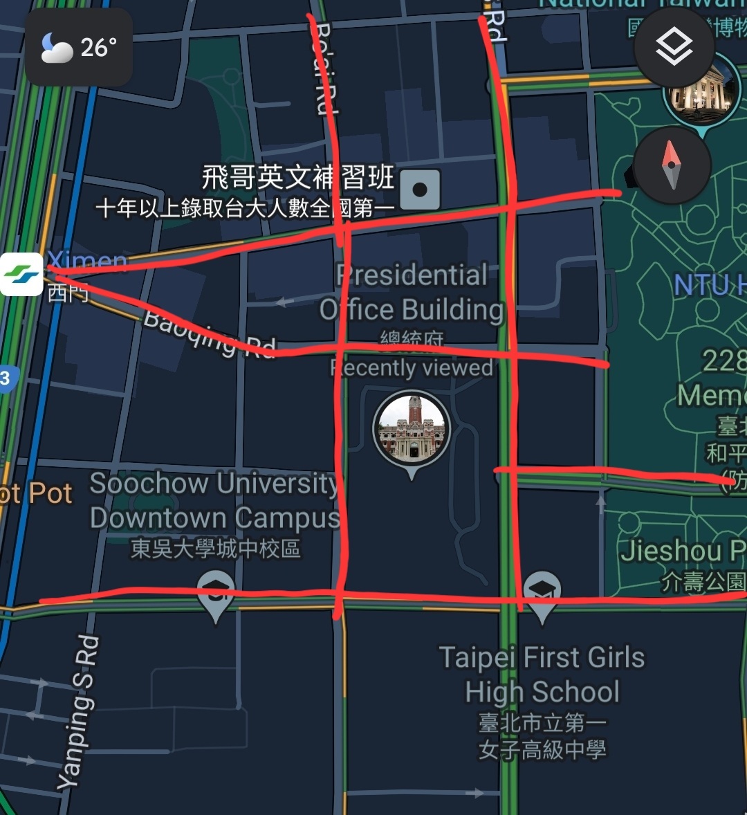
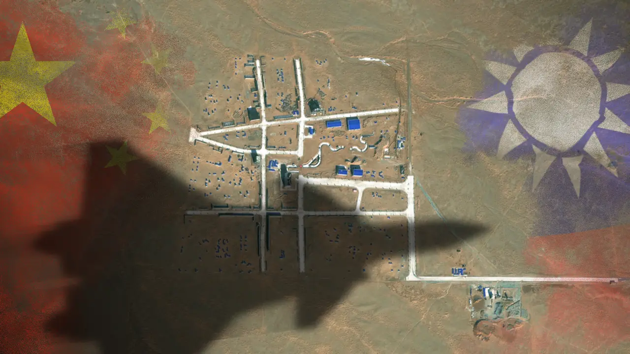
The satellite images reveal a layout of streets strongly resembling the Bo’ai Special Zone, a restricted area in Taipei’s Zhongzheng District that houses Taiwan’s most important state buildings, including the presidential palace, the supreme court, the ministry of justice and the central bank of Taiwan.
The Bo’ai Special Zone is subject to specific regulations, including a strict ban on overflight.
Maybe it’s just me, but if I look up the Taiwanese presidential palace on Maps and compare the surrounding streetplan to the plan in this article, I don’t see many similarities.
Try harder next time