
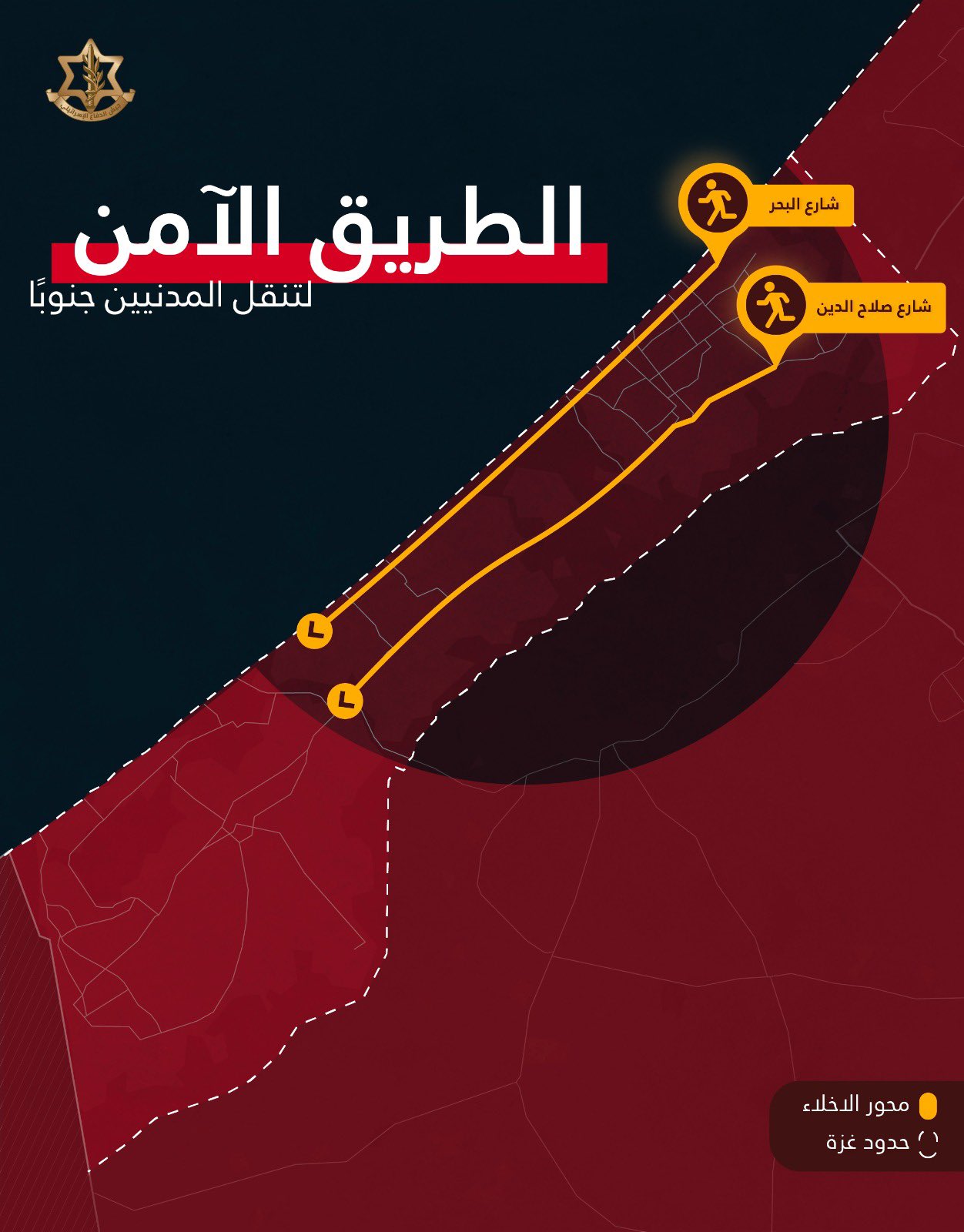
The IDF Spokesman Twitter account for Arabic has published guidance for Gazans to evacuate along two main roads between 10am and 4pm today (October 14th).
Translation courtesy of @hassanmckusick:
#Urgent Important statement for residents of Gaza City In recent days, we have appealed to you to leave Gaza City to the south of Wadi Gaza in order to preserve your safety. I would like to inform you that the IDF will allow movement on the indicated streets without any harm between the hours of 10:00 - 16:00. For your safety, take advantage of the short time to move towards the south - from Beit Hanoun to Khan Yunis. If you care about yourself and your loved ones, go south as instructed. Rest assured that Hamas leaders have taken care of themselves and are taking cover from strikes in the region. Residents of Al-Shati, Al-Rimal and West Al-Zaytoun will also be allowed to move on Daldul and Al-Sanaa Streets towards my street By At Saladin and the sea
Jerboa doesn’t show the link and the picture together: https://twitter.com/AvichayAdraee/status/1713065991511388610
The walking estimate is around 5 hours
If you’re a healthy adult and not bringing all your remaining possessions, your elderly parents and your children.
Yes obviously, that goes without saying.
It’s a walking estimate and those obviously assume that you walk at an average constant pace for 5 hours without slowing down (or up) or stopping.
The estimate isn’t for estimating how long it will take them. It’s for getting an idea on how far it is. Then you can estimate time on your own, with variables such as children, bringing your stuff, etc.
It’s a lot easier to visualize the distance if you have an estimate of what it would take you, compared to a fancy map with no scale or anything.
Thank you! I can’t imagine being in that situation.